COASTAL CRETE
A high-resolution COASTAL Forecasting system for CRETE Island
Region
Mediterranenan sea
- Coastal Area of Crete-
Markets
Safety & disaster
Marine Navigation
Service
What we offer
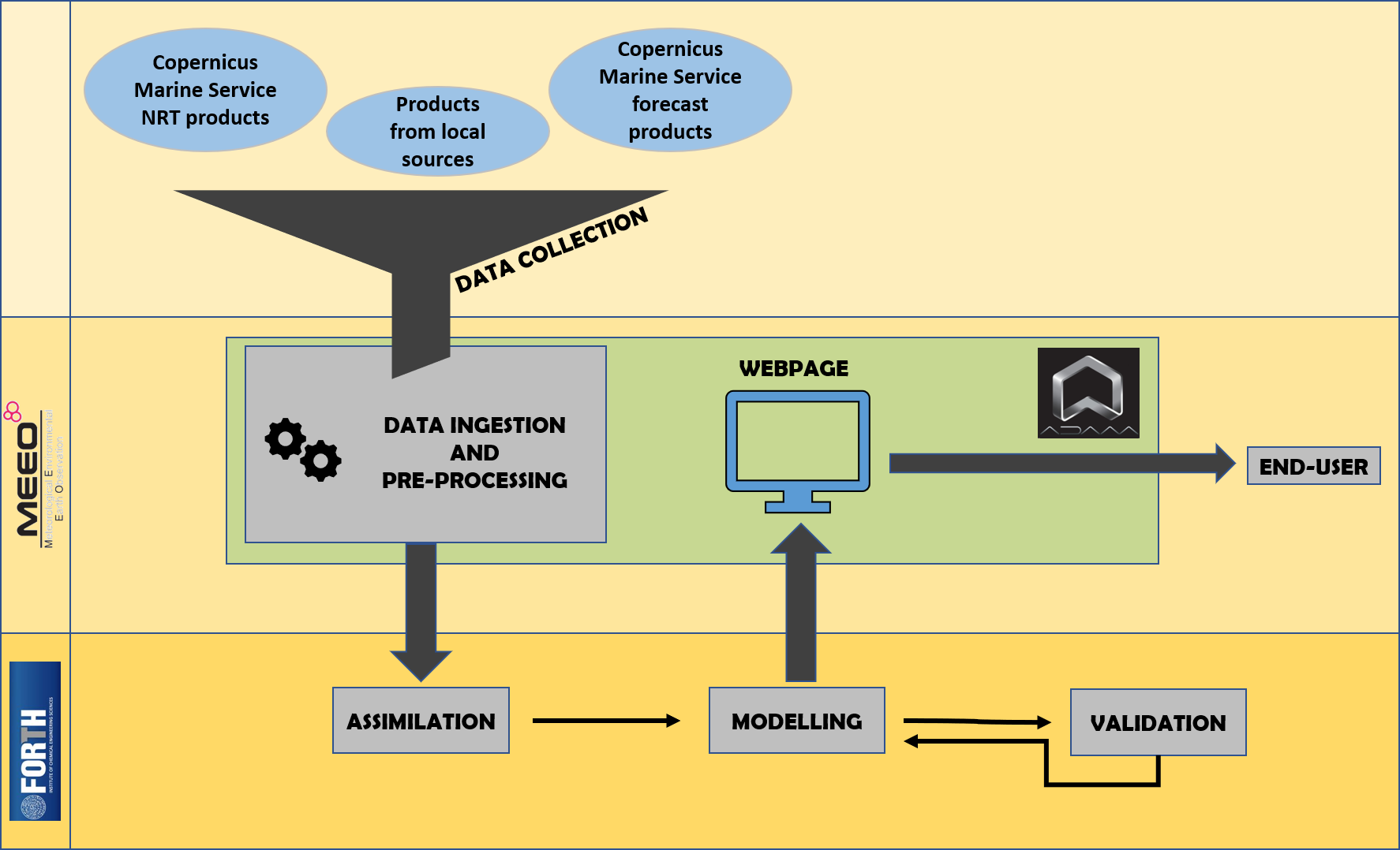
- COASTAL CRETE is an operational high-resolution coastal forecasting service for Crete Island, implementing advanced numerical hydrodynamic and sea state models nested in Copernicus Marine Service products
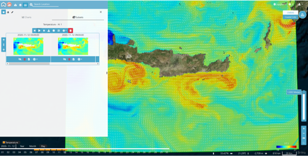
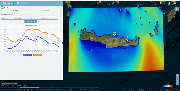
- The service provides hourly and 6-hourly averaged high-resolution short-term (5-day) forecasts of sea temperature, salinity, velocity fields, wave characteristics, on a daily basis
- COASTAL CRETE delivers (on demand) customized and ready to use information for maritime safety, e.g. predictions for oil spills and floating objects trajectories and very high-resolution currents and waves prediction for the transport and safety of ships
- Products and information are accessible and visualized through ADAM platform
Accessibility of the service
The information is distributed both in a free public basis (high-resolution short-term forecasts of marine parameters) and by paid premium services. Premium services may include information derived from very high-resolution (~ 200m) forecasts, non-public local data, user tailored information and specific alerts
Examples of such services are:
- Very high-resolution wave and currents forecasts
- Support to the response to environmental hazards such as oil spills (there was a pollution accident: where shall I put my response effort ?)
- Personalized early warnings and alerts (e.g. warn me when the waves become higher than 5 meters)
Benefits for users
- Availability of better forecast services.
- Lower risks in the decision making process, safer use of the marine environment.
- Availability of information focused on users specific needs through a single access point.
End users
COASTAL CRETE services are addressed both to the public and private sector. Examples of users in the coastal area of Crete are port authorities (e.g. Heraklion Port Authority S.A., Souda Port), the Hellenic Coast Guard, the shipping sector, oil and gas companies, the Region of Crete.
Copernicus Marine Service Products
The following Copernicus Marine Service Products are used as a basis of COASTAL CRETE service
Analysis and Forecast
- Mediterranean Sea Physics Analysis and Forecast.
- Mediterranean Sea Waves Analysis and Forecast.
Observations
- Mediterranean Sea High Resolution and Ultra High Resolution Sea Surface Temperature Analysis.
- Mediterranean Sea- In-Situ Near Real Time Observations.
- Mediterranean Sea Gridded L4 Sea Surface Heights and derived variables NRT.
Integration of Copernicus Marine Service Information
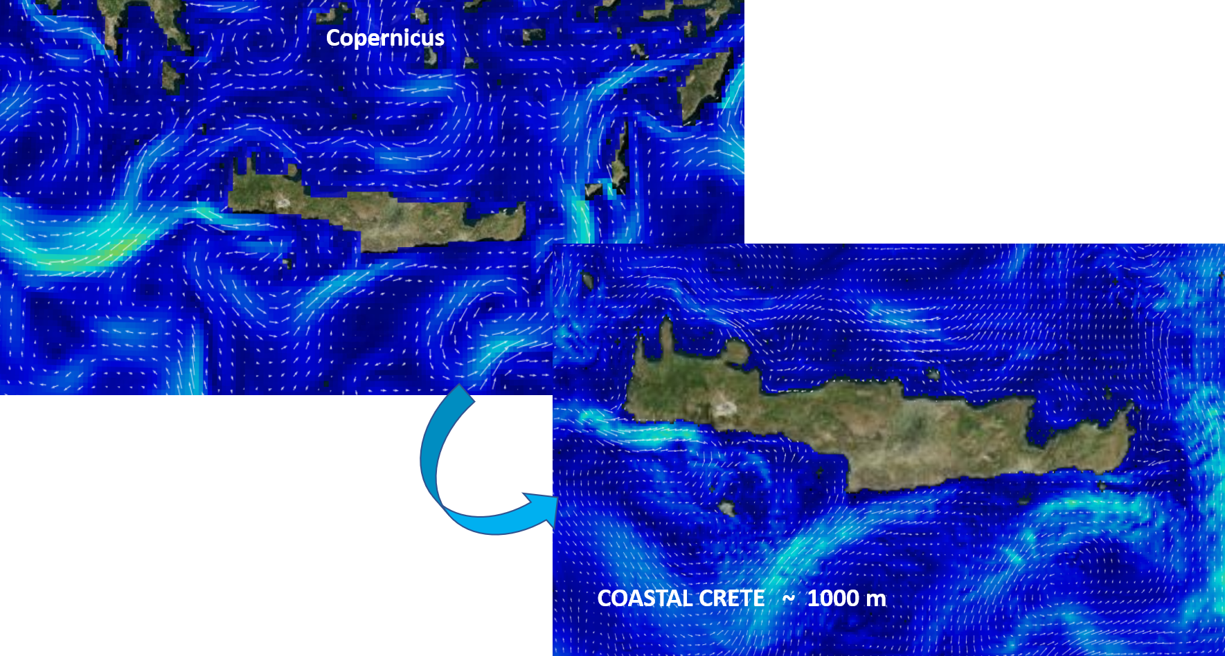
- Copernicus Marine Service products play a key role in the operational forecasting chain providing the required initial and open boundary conditions to run a series of nested hydrodynamic and wave models capable to deliver higher resolution information for sea temperature, salinity, velocity fields, wave height and period as well as data to validate the models.
- The Copernicus Marine Service products are quickly made available through ADAM platform as a geographic subset on the coastal area of Crete to allow the nesting of the higher resolution models into the Copernicus Marine Service models, model calibration/validation and data assimilation into the forecasting cycle
Visualisation of currents
Exploring COSTAL CRETE products at different depths
Adding points & extracting time series data
A high-resolution forecasting service that integrates Copernicus Marine Service Analysis and Forecast products and Observation Data.
The service provides hourly and 6-hourly averaged high-resolution 5-day forecasts of marine parameters for operators, scientists and business users, strengthening their maritime safety capabilities.
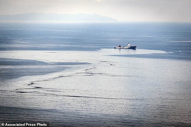
On demand simulation of different response actions in case of a pollution accident.
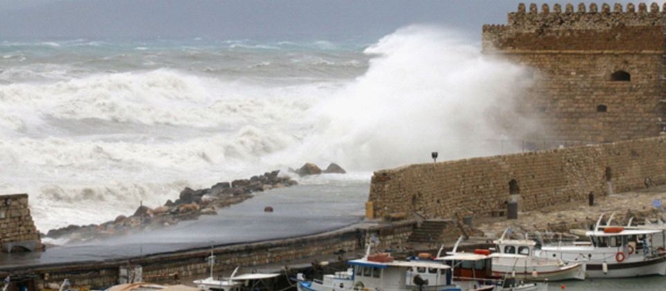
Early warnings and alerts (e.g. warn me when the waves are higher than 5 meters from north).
More information about the service:

More information about the Copernicus Marine Service:
Service contact: servicedesk.cmems@mercator-ocean.eu